Talk of Wilson County TX Historic Towns

by Barbara J. Wood
Return to "Talk"

DEAF SMITH

Every tree tells a story

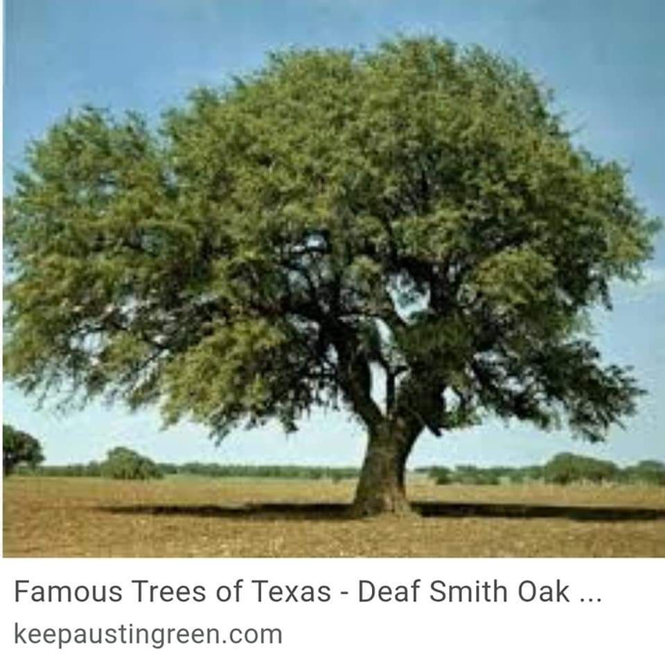
"It's been said that every tree tells a story.".....  If Texas' trees could speak, what stories they would tell—stories of love, honor, mystery, justice and injustice. The Deaf Smith Oak nearby in La Vernia Texas witnessed the Texas Revolution and the emancipation of African slaves that labored under its branches. 
 
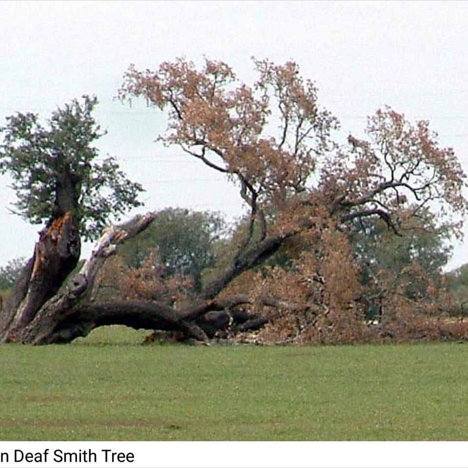
A celebrated witness to the beginning of the Texas Revolution left this world in 2014.
 
Crippled by countless lightning strikes, prairie fires, droughts and floods the Deaf Smith Oak crashed to earth on the eastern bank of the Cibolo (29.376408, -98.104492) It was a special tree recognized by the Texas Forest Service for its place in Texas history.
 
Located in a survey granted to Erastus "Deaf" Smith by the Mexican Government it stood in an open field about two miles north of La Vernia, Texas twenty-two miles east of San Antonio in Guadalupe County near its boundary with Wilson County.
 
In the 1820's, Byrd Lockhart laid out a road from the DeWitt Colony in Gonzales to San Antonio de Bejar. The Gonzales Road crossed the Cibolo at a natural ford on the Deaf Smith Survey. The Crossing exists in a deep bowl-shaped depression. The Deaf Smith Oak provided a perfect vantage point to view the Cibolo Crossing and the terrain in the direction of San Antonio.
 
In 1835, as tension grew, Mexico sent troops from San Antonio out the Gonzales Road to retrieve a cannon in Gonzales. Defying the Mexican troops with "Come and Take It", the first shot of the Texas Revolution was fired on the Gonzales Road.
 
Deaf Smith is believed to have climbed this tree to spy on the Mexican troops as they crossed the Cibolo. A pantheon of Texas heroes crossed the Cibolo under the Deaf Smith Oak. Stephen F. Austin brought his new army to the successful Siege of Bejar, Travis's letter pleading for help and re-enforcements for the Alamo passed its way.
 
Susanna Dickinson, survivor of the Alamo, delivered the message of defeat to Sam Houston's troops at the Crossing. As a result, Sam Houston burned Gonzales and the "Runaway Scrape" commenced.
 
The Mexican Army pursued the retreating Texans through the Crossing to their defeat at San Jacinto by Sam Houston's forces.
 
In 1842, when the first boundaries of Guadalupe County were drawn, the Gonzales Road was established as it southern boundary. That boundary became a disputed issue when Wilson County was created in 1860. The Texas Legislature resolved that dispute between Wilson and Guadalupe County in 1874. The Road was replace by a straight line. The Road meandered back and forth across that line.
 
Neither county was interested in its maintenance; it was enclosed within private property. The Oak continued its vigil along a road that disappeared.
 
Before it fell, the Deaf Smith Oak witnessed the Texas Revolution and the emancipation of African slaves that labored under its branches. It stood silently as the Wild West, entered and left the stage.
 
Deaf Smith Oak Tree – rest in peace! ( It is said that the young live oak tree, planted at the corner of FM 775 @ US Hwy 87 was grown from an acorn from the Deaf Smith tree as are several of the live oak trees in the LaVernia City Park)
*****************
COURTESY / LostTexasRoads.com
Allen & Regina Kosub, writers of Lost Texas Roads say, "It is not about legends; it is about the ordinary people who live in the shadow of legends and are heroes in their own right."
Fb img 1675076878601

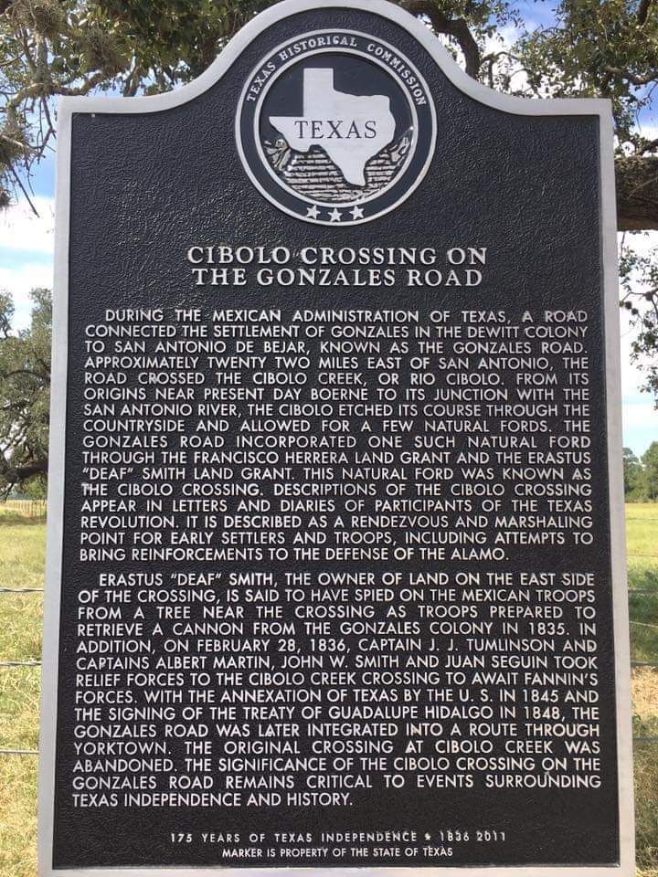
Cibolo Crossing on the Gonzales Road

Cibolo Crossing on the Gonzales Road  ...   Marker Text  "DURING THE MEXICAN ADMINISTRATION OF TEXAS, A ROAD CONNECTED THE SETTLEMENT OF GONZALES IN THE DEWITT COLONY TO SAN ANTONIO DE BEJAR, KNOWN AS THE GONZALES ROAD. 
 
APPROXIMATELY TWENTY TWO MILES EAST OF SAN ANTONIO, THE ROAD CROSSED THE CIBOLO CREEK, OR RIO CIBOLO. FROM ITS ORIGINS NEAR PRESENT DAY BOERNE TO ITS JUNCTION WITH THE SAN ANTONIO RIVER, THE CIBOLO ETCHED ITS COURSE THROUGH THE COUNTRYSIDE AND ALLOWED FOR A FEW NATURAL FORDS. THE GONZALES ROAD INCORPORATED ONE SUCH NATURAL FORD THROUGH THE FRANCISCO HERRERA LAND GRANT AND THE ERASTUS "DEAF" SMITH LAND GRANT. THIS NATURAL FORD WAS KNOWN AS THE CIBOLO CROSSING. 
 
DESCRIPTIONS OF THE CIBOLO CROSSING APPEAR IN LETTERS AND DIARIES OF PARTICIPANTS OF THE TEXAS REVOLUTION. IT IS DESCRIBED AS A RENDEZVOUS AND MARSHALING POINT FOR EARLY SETTLERS AND TROOPS, INCLUDING ATTEMPTS TO BRING REINFORCEMENTS TO THE DEFENSE OF THE ALAMO. 
 
ERASTUS "DEAF" SMITH, THE OWNER OF LAND ON THE EAST SIDE OF THE CROSSING, IS SAID TO HAVE SPIED ON THE MEXICAN TROOPS FROM A TREE NEAR THE CROSSING AS TROOPS PREPARED TO RETRIEVE A CANNON FROM THE GONZALES COLONY IN 1835.
 
 IN ADDITION, ON FEBRUARY 28, 1836, CAPTAIN J. J. TUMLINSON AND CAPTAINS ALBERT MARTIN, JOHN W. SMITH AND JUAN SEGUIN TOOK RELIEF FORCES TO THE CIBOLO CREEK CROSSING TO AWAIT FANNIN'S FORCES. 
 
WITH THE ANNEXATION OF TEXAS BY THE U. S. IN 1845 AND THE SIGNING OF THE TREATY OF GUADALUPE HIDALGO IN 1848, THE GONZALES ROAD WAS LATER INTEGRATED INTO A ROUTE THROUGH YORKTOWN. THE ORIGINAL CROSSING AT CIBOLO CREEK WAS ABANDONED. THE SIGNIFICANCE OF THE CIBOLO CROSSING ON THE GONZALES ROAD REMAINS CRITICAL TO EVENTS SURROUNDING TEXAS INDEPENDENCE AND HISTORY. "  
 
Marker Location on the west side of FM 775, .5 miles north of FM 2772 La Vernia Texas.